
How Can a Topographic Survey Support Road Widening Plans?
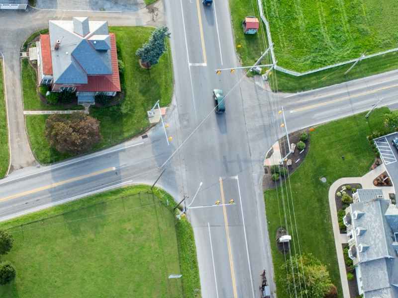
A topographic survey is the first real step in any road widening project. Not the design. Not the traffic study. The survey. It tells engineers exactly what the road looks like right now, down to the inch.
Map Existing Roadway Elevations Before Widening Design Begins
Before anyone can plan a wider road, they need to know exactly what the current road looks like.
A topographic survey records pavement elevations, shoulders, curbs, medians, and the ground next to the road. This becomes the starting map engineers use to plan the widening. Without it, they’re designing new pavement over a surface they don’t actually know.
Get this survey done early. A widening plan built on real elevation data needs fewer changes later. A plan built on old records or rough estimates almost always runs into surprises during design.
Locate Roadside Features That Could Affect the Wider Roadway
A road doesn’t sit alone. Sidewalks run beside it. Driveways cut into it. Power poles, drainage inlets, and retaining walls sit close to the edge, sometimes closer than anyone expects.
A topographic survey maps all of this. Every pole, every inlet, every driveway apron gets recorded and placed on the site map. That matters because these features often decide how far the road can actually widen.
A power pole standing two feet from the current shoulder can block an extra travel lane entirely, unless the design team knows it’s there. Find these features during the survey stage, not during construction, when moving a pole costs far more and slows down the whole project.
Use Terrain Data to Plan Smooth Connections With Existing Streets
A wider road has to connect to everything around it. Intersections. Driveways. The stretch of road just past the project limits.
Survey terrain data gives engineers the elevations they need to make those connections smooth. If the new pavement sits even an inch off from an existing driveway, drivers feel it every time they pull in or out. If a new lane doesn’t match the grade at an intersection, water can pool right where cars need to stop.
This isn’t about full earthwork calculations or grading plans (those come later, built on this data). This is about making sure the transitions actually work. Survey elevations give the design team the real numbers needed to line up new pavement with what’s already there.
Support Roadway Drainage Decisions Along the Expanded Corridor
Water follows the ground. Change the ground, and you change where the water goes.
Detailed elevation data shows the design team where runoff currently flows along the road corridor. That matters a lot once widening starts. Add a new lane, and you might block a path water has used for years. Change a shoulder slope, and water flow that used to soak into the ground might now flow straight into a driveway or a neighboring yard.
This is separate from bigger drainage structures like retaining walls or floodplain work. This is about the everyday flow of water along the road itself, and how widening might shift it. Survey data gives engineers the ground-level facts they need before locking in the drainage plan for the corridor.
Build a Survey Base for Road Widening Design Revisions
Road widening designs rarely stay the same from the first draft to the final plan. Lane widths get adjusted. Intersection improvements get added. Sidewalk locations shift as the project moves through review.
Every one of those changes needs to be checked against real conditions, not against an earlier draft. The topographic survey becomes that steady reference point. When a lane width changes or a sidewalk moves six inches, the design team can check it against the same accurate base map every time.
This is different from construction staking, which comes later and marks the final design out on the ground for crews to build from. The survey supports the design phase. Staking supports the building phase. Keeping these separate, and using the survey as the steady base throughout design, keeps the whole project grounded in facts instead of drifting draft by draft.
Frequently Asked Questions
When should a topographic survey be completed for a road widening project?
Surveying usually starts during early design or preliminary engineering. This lets the team build the widening plan around real roadway conditions before the geometry is finalized.
What roadway features are typically important in a topographic survey?
Common features include pavement edges, curbs, driveways, sidewalks, drainage structures, visible utilities, and any major elevation changes along the corridor.
Can a topographic survey help determine where additional roadway width can fit?
Yes. Existing terrain and roadside feature data help engineers test different widening options. Right-of-way limits, utility conflicts, and permitting requirements can also shape the final design.
