ALTA Survey | ALTA Land Survey | ALTA Land Title Survey
 An Alabama ALTA Title Survey is completed based on the “Minimum Standard Detail Requirements and Accuracy Standards For ALTA/ACSM Land Title Surveys.” This standards document was developed and is revised on a regular basis by a combination of Title industry and Surveying industry professionals. The latest version of this document is the 2011 revision.
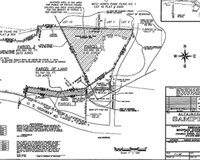
An ALTA Title Survey in Alabama is generally similar to a boundary or lot survey on a piece of property. But, the ALTA survey goes a little farther in the requirements on the land surveyor as he/she carries out the survey, both in the field and in the office.
ALTA Title Surveys are generally used on commercial or multi-family residential sites and also when either the lender or owner is in another state jurisdiction. The ALTA standards are somewhat of a “national standard” for surveying, intended to yield a consistent survey no matter what state the work is done in. While most States have surveying standards, they vary widely from one state to the other. So, the ALTA standard is used to cut down on this variation.
Since ALTA Surveys take more time and effort, these surveys typically cost more than a survey done according to a particular state standard. It should be pointed out that if the state standard is more restrictive on a certain point, then the most restrictive standard is required on the survey. I see ALTA surveys priced from 50% to 200% more than a comparable boundary survey. This depends on the items checked in “Table A – Optional Survey Responsibilities and Specifications.” This table adds additional or specific tasks to the surveyor’s scope of work. One item that is usually included with most all ALTA survey requests is Item #1, monuments placed. Most state standards probably include this and, in my opinion, all surveys should, but the ALTA survey leaves this optional unless the item is checked on Table A.
 In regard to this, one of the things I appreciate is that the client is “supposed to” not only fill out this Table A but also to furnish title documents to the surveyor BEFORE he starts the survey. In practice we rarely get the title documents until we issue the first draft of the survey. At that time the documents are sent to us and we are asked to revise the survey and show them. While this is not the way its planned, at least we have the chance to review the documents before issuing the final version of the survey.
“ALTA” in ALTA Survey stands for the American Land Title Association
So, if you have a commercial parcel or a large multi-family residential complex in the Hoover area, you should consider asking for the ALTA survey standards to be used. You should also probably do this if you are considering the purchase or development of a parcel outside your state. Most of the banks will require this if you ask for a loan on this type property, but I recommend this even if the bank doesn’t require it.
What are the requirements of the ALTA/ACSM Land Title Survey?
- Deeds and easements must be provided to the land surveyor prior to the survey
- The ALTA survey drawing should be a minimum size to accurately show the items found in the field
- All of the dimensions of the property must be shown so that the minimum survey precision can be met
- Show differences between the survey measurements and recorded measurements, if any
- The recorded documents or maps relied upon to perform the ALTA survey must be referenced on the survey drawing
- The type of monuments that occupies each property corners must be shown on the ALTA survey drawing
- Any evidence observed of any possession line over or onto the property must be shown
- Easements affecting the property must be shown on the drawing
- All improvements (fences, retaining walls, and buildings) will be shown on the survey drawing out to five-feet beyond the property boundary
- A contract between the owner and the land surveyor which authorizes the surveyor to proceed and providing payment to the surveyor
