↓
 

Hoover Land Surveying

...professional land surveyors in the Hoover, Alabama area.

Hoover Land Surveying
  • Home
  • ALTA Title Survey
  • Boundary Surveying
  • Construction Surveying
  • Drone LiDAR Mapping
  • Elevation Certificate
  • Land Surveying
  • Topographic Survey | Topo Survey
  • Blog
  • Contact Us
Home - Page 2 << 1 2

Post navigation

Newer posts →

5 Common Property Disputes That a Land Survey Could Have Prevented

Hoover Land Surveying Posted on May 25, 2026 by HooLaSuMay 21, 2026
Land surveyor measuring a property boundary to help prevent fence disputes and encroachment issues

Property disputes are more common than most people think. They can delay a sale, rack up legal fees, and damage relationships with neighbors for years. The good news is that many of these problems have one simple solution: getting a land survey done before they happen. A survey gives you a clear, legal picture of your property. Without one, small mistakes can turn into big, costly problems.

Here are five of the most common disputes and how a survey could have stopped each one.

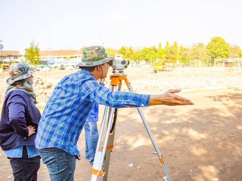
1. Fence Line Disputes

A fence line dispute happens when a fence is built in the wrong spot, either on a neighbor’s land or past the legal property line. This is one of the most common neighbor conflicts and one of the easiest to avoid.

It usually starts with good intentions. A homeowner puts up a fence based on where they think the line is. Years pass. Then a new neighbor moves in, orders a survey, and finds out the fence has been sitting two or three feet into their land the whole time.

At that point, someone has to move the fence. Legal fees and hard feelings tend to follow if the two sides cannot agree.

A boundary survey done before any fence goes up shows the exact property line. The fence is built in the right place, and there is no dispute.

According to the American Congress on Surveying and Mapping, nearly 35% of all property disputes in the United States involve boundary problems. Fence line conflicts make up a large share of those cases.

2. Encroachment by Structures

Encroachment happens when a structure like a shed, garage, or deck is built partly or fully on someone else’s property. This is harder to fix than a fence dispute and far more expensive.

Moving a fence takes a weekend. Moving a garage or tearing down a deck can cost thousands of dollars. A court may even order the structure removed, even if it was built years ago with no bad intent.

Encroachments are often found during a home sale. A buyer orders a survey, and a $300 report reveals a problem that holds up a $400,000 deal. The sale may fall through, or the seller may have to drop the price or fix the issue before closing.

A survey done before you build near a property line removes this risk entirely.

3. Easement Conflicts

An easement gives someone else the legal right to use part of your land for a set purpose. Common examples include a utility company accessing power lines, a shared driveway, or a path that gives a nearby owner access to a road.

Easements stay with the land, not the owner. When you buy a property, you also take on any easements that come with it. The problem is that many buyers do not know about them until after they close.

A homeowner might plan to build a pool in the backyard, only to find out a utility easement runs right through that spot. The utility company has the legal right to be there, and the pool cannot be built.

A detailed survey shows all recorded easements on a property. You know what you are buying before you sign anything.

4. Boundary Errors in Property Deeds

A boundary error happens when the written description of a property in its deed does not match the actual land on the ground. These errors are more common than most people expect.

Old deeds sometimes use landmarks that no longer exist, like a tree that was cut down or a creek that shifted course. When a surveyor goes out to measure the land using that old description, the numbers do not add up.

Boundary errors can affect the size of a property by hundreds of square feet, or by acres in rural areas. They can also mean that a neighbor has been using land that legally belongs to someone else, which can lead to legal claims under some state laws.

A survey catches these errors early. If a deed description is wrong, it can be fixed before it leads to a costly legal fight.

5. Setback Violations

A setback is the minimum distance a structure must sit from a property line or road, as required by local zoning rules. Building too close to a line is called a setback violation, and it can have serious results.

Setback violations often turn up during a home sale. A lender orders a survey, and the report shows a garage or addition was built too close to the lot line. The homeowner may then need to get a special permit, alter the structure, or watch the sale fall apart.

In some cases, a structure built in violation of setback rules cannot be financed at all. That makes it almost impossible to sell.

A construction survey done before breaking ground confirms that every structure is placed within the legal limits. It is a small cost compared to what a violation can end up costing.

What These Disputes Have in Common

All five of these problems share one thing: they are almost always preventable. A land survey done at the right time, whether before buying, before building, or before putting up a fence, gives you the facts you need to avoid conflict.

Surveys are not just for lawyers and developers. They are a useful tool for any property owner who wants to protect what they own.

Protect Your Property Before Problems Start

Most property disputes do not start with bad intentions. They start with missing information. A land survey fills in that gap. It gives you a legal record of your property that protects you, your investment, and your relationship with those around you.

If you are buying land, planning to build, or unsure of where your property lines are, reach out to a licensed land surveyor in your area today.

Frequently Asked Questions

Can a land survey be used as evidence in a property dispute? 

Yes. A survey prepared by a licensed Professional Land Surveyor (PLS) is a legal document. It can be used as evidence in court and is often the deciding factor in boundary and encroachment cases.

What if my neighbor refuses to accept the survey results? 

You cannot force a neighbor to agree, but you can use the survey to support your case in mediation or court. A certified survey from a licensed surveyor carries strong legal weight.

How do I find out if my property has any easements? 

Ask for a title search and a detailed survey before you close on a property. Your title company can also pull a report on any easements or other rights tied to the land.

Is it too late to get a survey if a dispute has already started? 

No. A survey can be ordered at any time. If a conflict is already underway, a current survey can help lay out the facts and may lead to a faster resolution.

Posted in land surveying | Tagged land surveying

What Is Land Surveying And Why Does It Matters?

Hoover Land Surveying Posted on May 22, 2026 by HooLaSuMay 21, 2026
Land surveying professional using GPS equipment to measure property boundaries near a roadway

Land surveying is the process of measuring land to find its exact size, location, and borders. A licensed surveyor uses GPS tools and property records to create a legal document called a survey plat. This document shows exactly where your land begins and ends. Surveys are used when buying or selling land, building on a property, and settling land disputes.

What Is Land Surveying?

Land surveying has been around for thousands of years. Ancient Egyptians used it to redraw farm lines after floods washed away their markers. The Romans used it to build roads and cities. Today, the tools are more advanced, but the goal is still the same: find out exactly where a piece of land is and what it looks like.

Every land survey answers three basic questions:

  • Where is this property located?
  • Where are its legal borders?
  • What features are on or around it?

The findings go into a survey plat, which is a legal document filed with the county. It can be used as proof in court if a dispute ever comes up.

There are about 44,000 licensed surveyors in the United States, according to the U.S. Bureau of Labor Statistics. In most states, surveyors must pass national exams before they can sign any legal survey document.

Types of Land Surveys

There are several kinds of land surveys. Each one serves a different need. Knowing which type you need can save you time and money.

Boundary Survey

A boundary survey finds the exact edges and corners of a piece of land. It is the most common type. You will likely need one when buying, selling, or splitting a property.

Topographic Survey

A topographic survey maps the physical features of a property. This includes hills, slopes, trees, buildings, roads, and buried utility lines. Engineers and architects use this survey when planning a structure that needs to fit the shape of the land.

Construction Survey

A construction survey is done during a building project. It marks where the foundation, roads, and utility lines should go. This helps make sure what gets built matches the approved plans. Without it, a building could end up in the wrong spot, which leads to costly repairs and legal trouble.

ALTA/NSPS Survey

This is the most detailed type of survey. It is named after the American Land Title Association and the National Society of Professional Surveyors. It covers borders, easements, zoning, and any overlaps between properties. Banks and title companies almost always ask for this type before approving large commercial property deals.

Flood Elevation Certificate

This survey measures how high a structure sits compared to the local flood level in the area. The Federal Emergency Management Agency (FEMA) and many mortgage lenders require this document to set flood insurance rates.

Why Land Surveying Matters

A survey gives you legal proof of what your property looks like on paper. Without one, you are working off guesses, and guesses can cost a lot of money.

The American Congress on Surveying and Mapping reports that nearly 35% of all property disputes in the United States involve border problems. Most of those could have been avoided with a survey. The American Land Title Association also reports that title problems, including border errors, appear in about 25% of all real estate deals in some form.

Here is how a survey protects you:

  • Legal proof. A recorded survey can be used as evidence in court.
  • Title insurance. Most title companies need a survey before they issue a title insurance policy.
  • Loan approval. Banks often require a survey before approving loans on commercial or undeveloped land.
  • Building permits. Local governments check survey data to confirm a planned structure follows local rules.
  • Spotting overlaps. A survey shows if a neighbor’s fence or driveway crosses into your land, or if yours crosses into theirs.

Finding these problems before a sale closes is far cheaper than dealing with them after.

How a Land Survey Works

A land survey happens in three steps: research, fieldwork, and drafting. The whole process usually takes one to four weeks. The timeline depends on the size of the property and how complex its history is.

Step 1: Research

The surveyor starts by reviewing records. This includes the property deed, past survey plats, county files, and legal descriptions. This background work gives the surveyor the context needed before going out to the field.

Step 2: Field Measurements

The survey crew visits the property with GPS devices, measuring tools, and optical instruments. They look for existing border markers, take measurements, and record what they find. For large or hard-to-reach sites, some surveyors also use drones to collect data from above.

Step 3: Drafting and Signing

The crew brings all the data back to the office. They draw it into a formal plat using design software. The licensed surveyor then signs and stamps the final document. That signature makes it a legal record that can be filed and used in court.

Frequently Asked Questions

Do I need a survey before buying a home? 

It is not always required by law, but it is a smart move. A survey can uncover border issues, easements, and overlaps before you sign the purchase agreement.

How much does a land survey cost? 

A basic residential boundary survey in the United States usually costs between $500 and $2,500. A detailed commercial survey can run from $3,000 to $10,000 or more, depending on the size and complexity of the site.

Who can legally perform a land survey? 

Only a licensed Professional Land Surveyor (PLS) can produce a survey that holds up in court. Getting that license requires schooling, field experience, and passing a national exam.

What is the difference between a survey and an appraisal? 

A survey defines the physical borders of a property. An appraisal estimates what the property is worth. They do different things and are done by different professionals.

Posted in land surveying | Tagged land surveying

Post navigation

Newer posts →
Get Quote Button
Order an ALTA Survey Hoover AL
© 2020 Boxer Survey USA
HooverLandSurveying.com
Address: Hoover, Alabama
Phone: (205) 402-8050

Web Development and SEO by:
AuburnBusiness.com, LLC


Privacy Policy | Terms of Use

The owner of this website, Boxer Survey USA, provides coordination of professional land surveying and engineering services in all 50 states. The professional surveying and engineering services provided to you will be conducted by fully licensed professionals in your state.

&nbsp Privacy Policy
↑